Lake Tour
Cultural tours

Description:
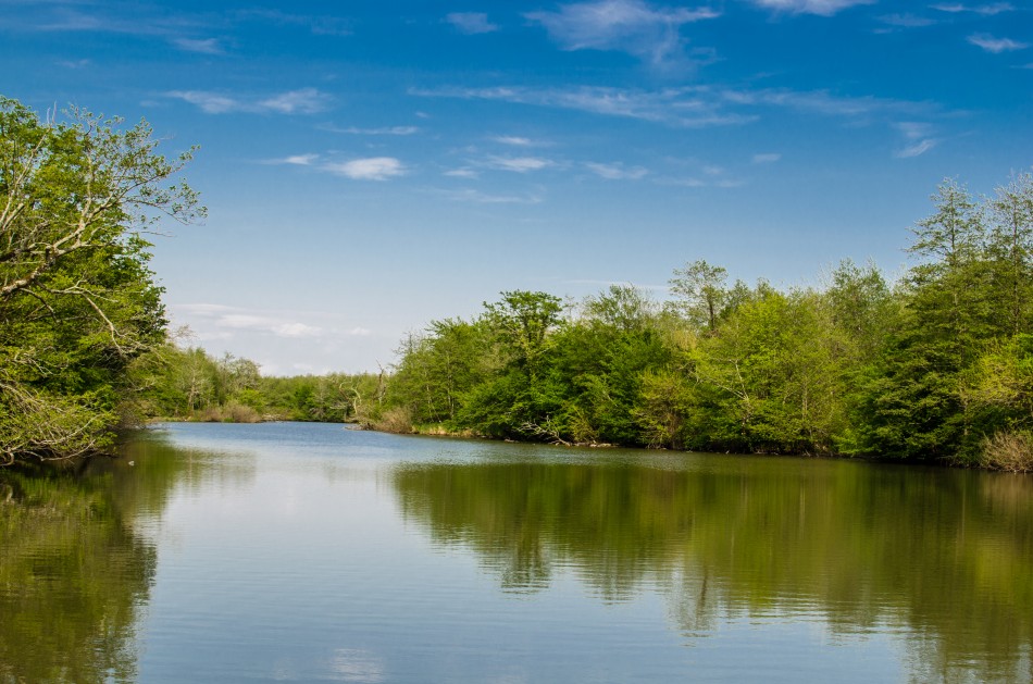
Turtle lake: Located at the northern slope of Mtatsminda ridge, at an altitude of 686.7 meters. Surface area - 0.034 km2, the basin area - 0.4 km 2, The largest depth - 2,6 m, the average depth - 1.7 m. Lake's length is 180 meters and width - 50 m.
Turtle Lake is fed by rain and groundwater.
Lake is Poor with fish. Turtle Lake and its surroundings are comfortable.
There are often held Sporting events .
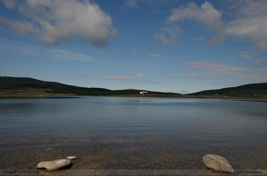
Bazaleti lake: The Bazaleti Lake (Georgian: ბაზალეთის ტბა) is a lake in eastern Georgia some 60 km northwest of the nation's capital Tbilisi and 5 km south of the town of Dusheti. It is used for fish culture, irrigation and recreation. The nearby village and the historical district around the lake are also known as Bazaleti. The surface area of the lake is 1.22 km². and its maximum depth is 7 m. The area around the lake housed a flourishing medieval town and is surrounded by many legends. In 1626, the Battle of Bazaleti between two rival Georgian factions took place there. Currently, the area is a popular recreational area served by a modern tourist complex. It is known that Bazaleti lake has an outflow but it has not been discovered. Locals claim that the water recirculates. They tell a story about a bull which was drowned in the lake and was later found in a well in the nearby village. According to local legend, a golden-haired child is lying in a golden crib on the bottom of the lake. The lake was formed from his mother's tears. The story is retold in a Georgian poem.
Turtle lake: Located at the northern slope of Mtatsminda ridge, at an altitude of 686.7 meters. Surface area - 0.034 km2, the basin area - 0.4 km 2, The largest depth - 2,6 m, the average depth - 1.7 m. Lake's length is 180 meters and width - 50 m.
Turtle Lake is fed by rain and groundwater.
Lake is Poor with fish. Turtle Lake and its surroundings are comfortable.
There are often held Sporting events .
Bazaleti lake: The Bazaleti Lake (Georgian: ბაზალეთის ტბა) is a lake in eastern Georgia some 60 km northwest of the nation's capital Tbilisi and 5 km south of the town of Dusheti. It is used for fish culture, irrigation and recreation. The nearby village and the historical district around the lake are also known as Bazaleti. The surface area of the lake is 1.22 km². and its maximum depth is 7 m. The area around the lake housed a flourishing medieval town and is surrounded by many legends. In 1626, the Battle of Bazaleti between two rival Georgian factions took place there. Currently, the area is a popular recreational area served by a modern tourist complex. It is known that Bazaleti lake has an outflow but it has not been discovered. Locals claim that the water recirculates. They tell a story about a bull which was drowned in the lake and was later found in a well in the nearby village. According to local legend, a golden-haired child is lying in a golden crib on the bottom of the lake. The lake was formed from his mother's tears. The story is retold in a Georgian poem.
Abudelauri lake: Abudelauri lake - glacier Lake in eastern Georgia in the district Dusheti municipality, the southern slope of the Caucasus -Khevsureti therefore, the right tributary of the river roshkisckali topped Abudelauri (Khevsureti Aragvi pool), 2812 m above sea level, an area of 0,035 square kilometers. The maximum depth 3.8 meters, the volume 45 500 m³. Fed by snow, rain and glacier water. The maximum level is in the summer, the minimum - in winter. Long period of time (more than 6 months) ice-covered. Ice is released from the end of May, there is a lake without fish.
Tabatskuri lake: The Qtsia-Tabatskuri wetland was designated in 1995. Protection of bird species such as Ciconia nigra and C. ciconia, Grus grus, Crex crex, Melanitta fusca and their habitats, including the unique mountain wetlands along the headwaters of the River Qtsia and around the Lake Tabatskuri. The wetlands of Qtsia- Tabastkuri have high protection value and The Bird life International rated the protected territory as one of the most important habitat staging post to migratory bird. (IBA- international status). The Qtsia, due to its unique forest ecosystem, wetland vegetation and hyper-humid landscapes, is designated as a category IV protected area under Georgian national law and its has been proposed to Ramsar site list as a protected area of Georgia. As a consequence of its location, and its physical and climatic diversity, The Qtsia-Tabatskuri wetland has a remarkably rich and diverse flora in comparison to other region of the country. There is a high level of endemism, which includes components of various biogeographical origins native to the wetland.
Mtsvane (green) lake: In the upper Adjara, there is a beautiful lake. The local population call it ,,Green lake”. The lake straddles the vast mountains and is limited with fir-grove and beech. Mountains are reflected in the mirror of the clean water.
Paliastomi lake: Instant Lake Odishi plain-region, in the near of the town Poti, Samegrelo region. Surface area -18.2 square kilometers. The basin area - 547 square kilometers, a maximum depth -3.2, an average depth- 2.6 m. The water volume is 52 million. M³. Located above sea level - 0.3 m below. Nourished by the rain water and tributaries. lake is attached to the river Pichori. The water is warm July-August (25,1 ° C), cold in January (5,2 ° C). In 1924, the South-West coast of the lake from the channel and directly joined to the sea, while in December 1933 as a result of strong waves expanded channel and appeared in the strait, the water became brackish. Lake is included in Colchis National Park, it offers to the tourists boat tours for better understanding of the lake.
Tobavarchkhili lake: The legend tells that in early years the inhabitants of Samegrelo (Region in Georgia) were in a trouble with the strange conqueror and had no power to struggle against him, but one day a good soul Giant ARAMKHUT (Georgian version of Prometheus) appeared just in time, and the natives asked him to save them from the stranger. The Giant ARAMKHUT jointed the next attack of the conqueror and went in battle with the OCHOKOCH (a small men, with short legs and hands whose whole face and body were covered by hair). The Giant located on the top of Kvira Mountain and Ochokoch on the top of Okhachkue hill and threw the cobble stones to each other. Wide of the mark stones originated big holes on Kvira and Okhachkue down hills. These holes suffered the time and even now they are visible for the visitors in shape of shell hole. The natives call these holes “algd” and the shepherds use the “Djisht” (non-consumable snow there) as a refrigerator. The battle ends with the victory of the Giant Aramkhutu, he killed Ochokoch, but Ochockoch’s last stone delivery wounded the Giant in his arm. Aramkhut washed his bloody arm in Tobavarchkhili lake, after that the water in the lake became holy, because Aramkhut was an ancestor of the GOD. Since that, when you wash your hands in Tobovarchkhili lake will point to heavy rain and thunder storm.